Water and Fire combined a range of creative, community-based methods to explore understandings and actions at the household and individual levels across all three phases of the “disaster cycle”.
Household Interviews
Early in the Water and Fire project, we used structured interviews to survey 200 households in each of the three sites. The core team worked with local residents and stakeholders to create a set of questions. Community engagement workshops were held in each sites to introduce the project team, aims and objectives to the community. Based on feedback and input from the workshop participants, the team developed a household survey that was initially planned to be conducted face-to-face. Then Covid-19 hit and the interviews had to be adapted to be conducted remotely using mobile phones and the CommCare online platform.
The findings from these surveys shaped the remaining methods, which aimed to elicit more detailed, individual accounts of water scarcity, fire and flood experiences. We wanted to give our co-researchers the opportunity to tell personal stories of both their responses to these environmental hazards and their thoughts on what might lead to improvements in their capacity to reduce risk and damage. To help achieve this, we adopted three creative methods that generated some of the materials on display here today: digital story-telling, community mapping/walking interviews and photovoice.
Digital story-telling
We followed the workshop approach to creating digital stories developed by the Center for Digital Storytelling (now StoryCenter). For each site, we held a 5-day workshop during which participant co-researchers created short videos describing specific episodes or incidents of water scarcity, fire or flood they had experienced. A series of specific and general co-produced questions relating to the participants, their households, their thoughts and understanding of the challenges in their locality were used to develop the narratives.
The co-researchers used a variety of materials, including paint, marking pens, pastels, crayons and collage to produce visual representations of their stories. They then recorded a narration. The audio and still images were combined to make short films. Eight stories were created for each of the 3 sites.

Community mapping
The digital stories focused on a single episode or incident that our co-researchers had experienced. We also wanted to understand more about spatial and temporal patterns of risk and hazard within the three neighbourhoods. To do this, we used a process that combined elements of walking interviews with community mapping.
At the start of this process, 1-day project briefing workshop took place in which research questions, design, protocols and ethical considerations were shared and discussed among the participants. We drew on both the household surveys and the digital stories to develop some high-level questions to prompt further debate and discussion.
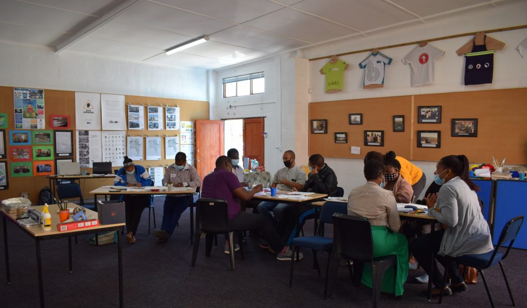
Following these initial workshops, field researchers visited each of the three neighbourhoods and were shown around by communnity-based co-researchers and other community members. Over several days, groups of 2-3 community members led pairs of the field researchers, who also had street and suburb maps with them, in a walkabout in their area along a route chosen by themselves. Along the way, they discussed how the particular environmental hazard affected their neighbourhood, and raised development issues and challenges within the site. Participants also documented various inputs and perspectives on the field researchers’ maps.

Two different types of map were used to guide the research process:
- A digital aerial map was provided to each participant at the suburb scale allowing respondents to highlight major collective features that they believe to play a role in the research context. This included reflections on broader area dynamics, impact of adjacent areas (for example bushland or natural water sources), respondent perceptions on origins of environmental risk (such as fires or localised flooding).
- Each participant group was asked to draw a map at their street / neighbourhood scale to reveal the important localised factors of relevance to the development issues. This included disaster influenced matters such as geographic areas of conflict or cohesion, resources, flash points (e.g., for localised flooding; emergency vehicle entry point congestion, etc.), or solutions.
The materials generated during the community mapping processes were revisited, analysed and consolidated by the co-researchers in subsequent workshops.
Photovoice
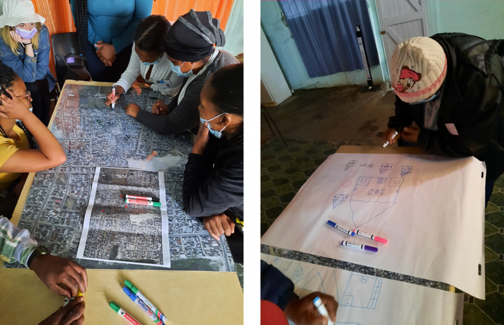
In addition to the community mapping processes, we also wanted to give co-researchers the opportunity to tell their own stories of their environments and experiences using photographs of their own choice, taken in their own time. Co-researchers were provided with a digital camera to capture various aspects (e.g., spaces, places or objects) of their lived experiences in relation to the research topics of drought, flooding and fire. Each captured image was stored on the camera and was later reviewed by the participant, who then, following some guided reflection, developed a title and caption.
In this way, the images and accompanying titles/captions were entirely the product of the participants, reflecting their own perspectives and opinions on these important local challenges.

The co-researchers had the cameras for several days and were able to take pictures in their own homes and around their neighbourhoods. They were given some guidance in relation to capturing images that spoke to different phases of the disaster cycle, but were free to take them wherever and whenever they wished.
Co-researchers were then invited to a workshop in which they selected a number of their own photographs and developed titles and captions. Each co-researcher created a book of up to 30 such images.
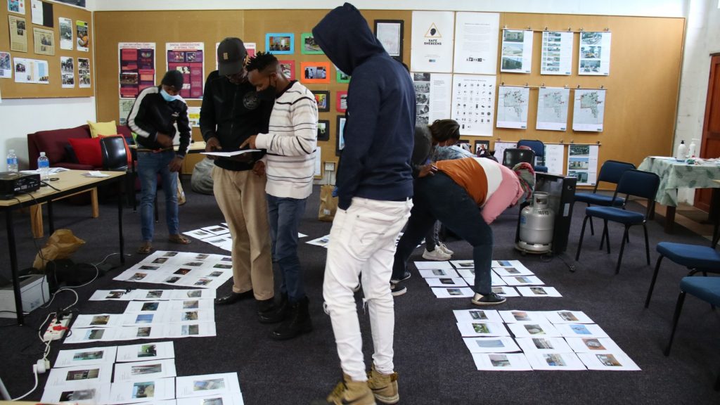
Co-researchers then narrowed down their selection and shared their chosen images with other participants. Together, they engaged in a process of co-analysis to identify central themes, articulating and deepening a community-generated narrative about their particular environmental hazard.
Through these processes, our co-researchers not only articulated their own and their communities’ experiences of and responses to drought, fire and flood: they also generated the initial inputs for the next step, in which they worked together to identify leverage points that could be acted on to make a difference in their own neighbourhood.